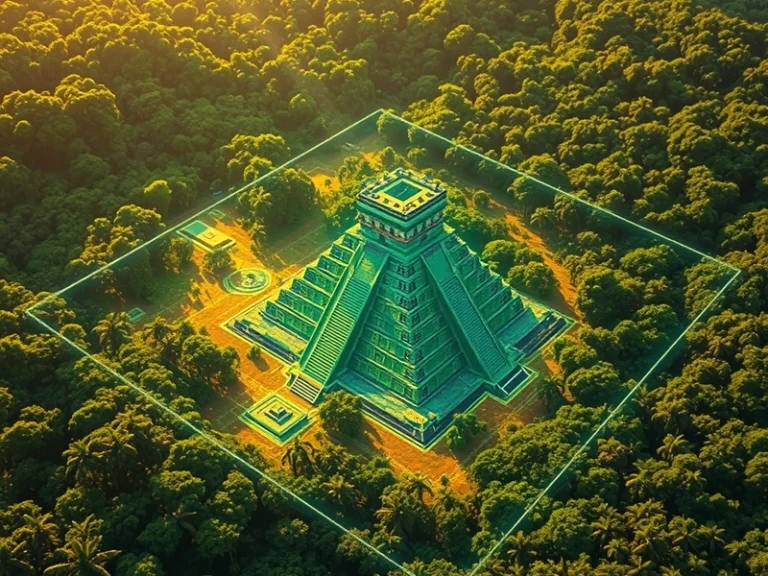
The application of artificial intelligence has led to a significant archaeological breakthrough, with a team leveraging 48 AI agents and lidar technology to rediscover a previously hidden pyramid deep within the ancient Maya jungle. This development underscores the transformative potential of advanced computational methods in uncovering the secrets of past civilizations, particularly in environments where traditional survey techniques are rendered ineffective by dense vegetation.
The challenge of locating ancient structures in areas like the Maya lowlands has long been formidable. Centuries of jungle growth can completely obscure monumental architecture, making ground-based surveys painstakingly slow and often fruitless. This is where lidar (Light Detection and Ranging) technology has emerged as a game-changer. Mounted on aircraft, lidar systems emit millions of laser pulses per second towards the ground. These pulses penetrate the forest canopy, bouncing off the actual terrain and any structures present before returning to the sensor. By measuring the time it takes for each pulse to return, a highly detailed 3D map of the bare earth is generated, effectively stripping away the vegetation in the digital realm.
Lidar’s Role in Revealing the Unseen
For archaeologists, the raw lidar data is a treasure trove, but also an immense dataset requiring sophisticated analysis. This is where the integration of AI becomes crucial. The sheer volume of points in a typical lidar scan—often billions—makes manual interpretation impractical. Traditional methods might involve human analysts meticulously sifting through elevation models for anomalies that suggest human-made features. However, the subtle patterns indicative of ancient architecture, such as linear arrangements, rectangular shapes, or gradual slopes that form terraces, can be easily missed or misinterpreted amidst natural geological formations.
The Power of AI Agents in Data Interpretation
The deployment of 48 AI agents for this project represents a significant leap in data processing capabilities. These agents are essentially specialized algorithms designed to perform specific analytical tasks in parallel. Their collective intelligence allows for a multi-faceted approach to pattern recognition:
- Feature Extraction: Individual agents can be trained to identify specific archaeological features, such as building foundations, walls, roadways (sacbeob), agricultural terraces, or ceremonial platforms. They learn to distinguish these from natural topography based on characteristics like angularity, elevation changes, and spatial relationships.
- Anomaly Detection: Some agents might specialize in flagging anomalies in the lidar terrain model that deviate significantly from natural patterns, pointing to potential human modification of the landscape.
- Spatial Analysis: Other agents could focus on analyzing the spatial distribution of detected features, looking for clusters, alignments, or networks that indicate organized settlements or infrastructure. This includes identifying the characteristic layout of Maya urban centers, often organized around central plazas and pyramids.
- Noise Reduction and Data Cleaning: A portion of the agents might be dedicated to filtering out noise from the lidar data, correcting for errors, or filling in gaps, ensuring the subsequent analysis is based on the cleanest possible dataset.
By operating concurrently, these 48 agents can process vast swathes of lidar data exponentially faster and with greater precision than human teams or single-threaded algorithms. They can cross-reference findings, identify hierarchical structures within settlements, and even infer the function of different areas based on detected patterns. In this instance, their combined efforts successfully identified the distinct signature of a large pyramid, a structure that had remained hidden from view for centuries beneath the dense jungle canopy.
Implications for Maya Archaeology
The rediscovery of a hidden pyramid through this AI-powered lidar analysis holds profound implications for Maya archaeology. It suggests that many more significant structures and even entire settlements may still lie undiscovered in previously surveyed or seemingly impenetrable regions. For researchers, this means:
- Revisiting Known Sites: Existing lidar datasets of known Maya sites can be re-analyzed with these advanced AI techniques, potentially revealing previously unnoticed features or providing a more complete picture of their ancient urban sprawl.
- Targeted Excavation: The precision of AI-identified features allows archaeologists to conduct highly targeted ground surveys and excavations, dramatically reducing the time and resources traditionally spent on exploratory fieldwork. This can lead to more efficient and impactful research.
- Understanding Settlement Patterns: A more comprehensive map of Maya architecture will contribute to a deeper understanding of ancient Maya demographics, political organization, resource management, and inter-site relationships.
This project exemplifies a growing trend in archaeology where AI and remote sensing are not just tools, but integral partners in the investigative process. As AI models become more sophisticated and lidar technology continues to improve, the potential for uncovering and understanding ancient civilizations, not just in the Maya region but globally, will only expand. The “jungle” of data generated by modern survey techniques is now becoming legible through the collective intelligence of AI agents, promising a new era of discovery.